Curriculum
Smart4Food MicroLearning Course
INTRODUCTION
0/1
Module 1: Digital Tools for Smart Farming
0/22
-
MODULE 1 - INFORMATION
 Trial
-
MODULE 1 - INTRODUCTION
Trial
-
UNIT 1 - INTRODUCTION TO DIGITAL AGRICULTURE AND SMART FARMING TOOLS
Trial
-
UNIT 1 - QUIZ
 Trial
-
UNIT 1 - REFLECTION ACTIVITY
Trial
-
UNIT 2 - DIGITAL RECORD-KEEPING FOR FARM MANAGEMENT
Trial
-
UNIT 2 - REFLECTION ACTIVITY
Trial
-
UNIT 2 - QUIZ
Trial
-
UNIT 3 - REMOTE SENSING AND GEOSPATIAL ANALYSIS
Trial
-
UNIT 3 - IMAGE ACTIVITY: DESCRIBING NDVI PATTERNS
Trial
-
UNIT 3 - QUIZ
Trial
-
UNIT 4 – IoT SENSORS AND SMART IRRIGATION
Trial
-
UNIT 4 - SIMULATED DASHBOARD ACTIVITY
Trial
-
UNIT 4 - QUIZ
Trial
-
UNIT 5 – ARTIFICIAL INTELLIGENCE AND DATA ANALYTICS
Trial
-
UNIT 5 - WEATHER FORECAST ACTIVITY
Trial
-
UNIT 5 - QUALITATIVE COMPARISON ACTIVITY
Trial
-
UNIT 5 - QUIZ
Trial
-
UNIT 6 - DATA ETHICS, CYBERSECURITY AND SUSTAINABILITY
Trial
-
UNIT 6 - READING ACTIVITY
Trial
-
UNIT 6 - CASE SCENARIO ACTIVITY
Trial
-
UNIT 6 - QUIZ
Trial
Module 2: Sustainable and Regenerative Agriculture: Soil, Water and Biodiversity Management for Small-Scale Farms
0/16
Module 3 - Smart Marketing and Communication for Small Producers
0/27
Module 4 - Local Food Systems and Short Supply Chains
0/14
Module 5 - Training and Education for Rural Development
0/14
Module 6 - Policy Innovation and Project development in the Agrisector
0/15
UNIT 3 – REMOTE SENSING AND GEOSPATIAL ANALYSIS
Unit 3 – Remote Sensing & Geospatial Analysis
1. What remote sensing means in agriculture
Remote sensing helps farmers identify, describe, and monitor what is happening in their fields without being physically present.
It refers to collecting data from a distance using sensors on satellites, drones or aircraft. “Remote sensing refers to collecting data about the Earth from a distance using sensors on satellites, drones or aircraft.”
These sensors measure how surfaces reflect or emit light. Farmers can analyse this information to:
· Monitor crop growth
· Detect stress early
· Observe large areas quickly
· Apply better management decisions
In agriculture, remote sensing helps farmers monitor crops over large areas without stepping into every field.
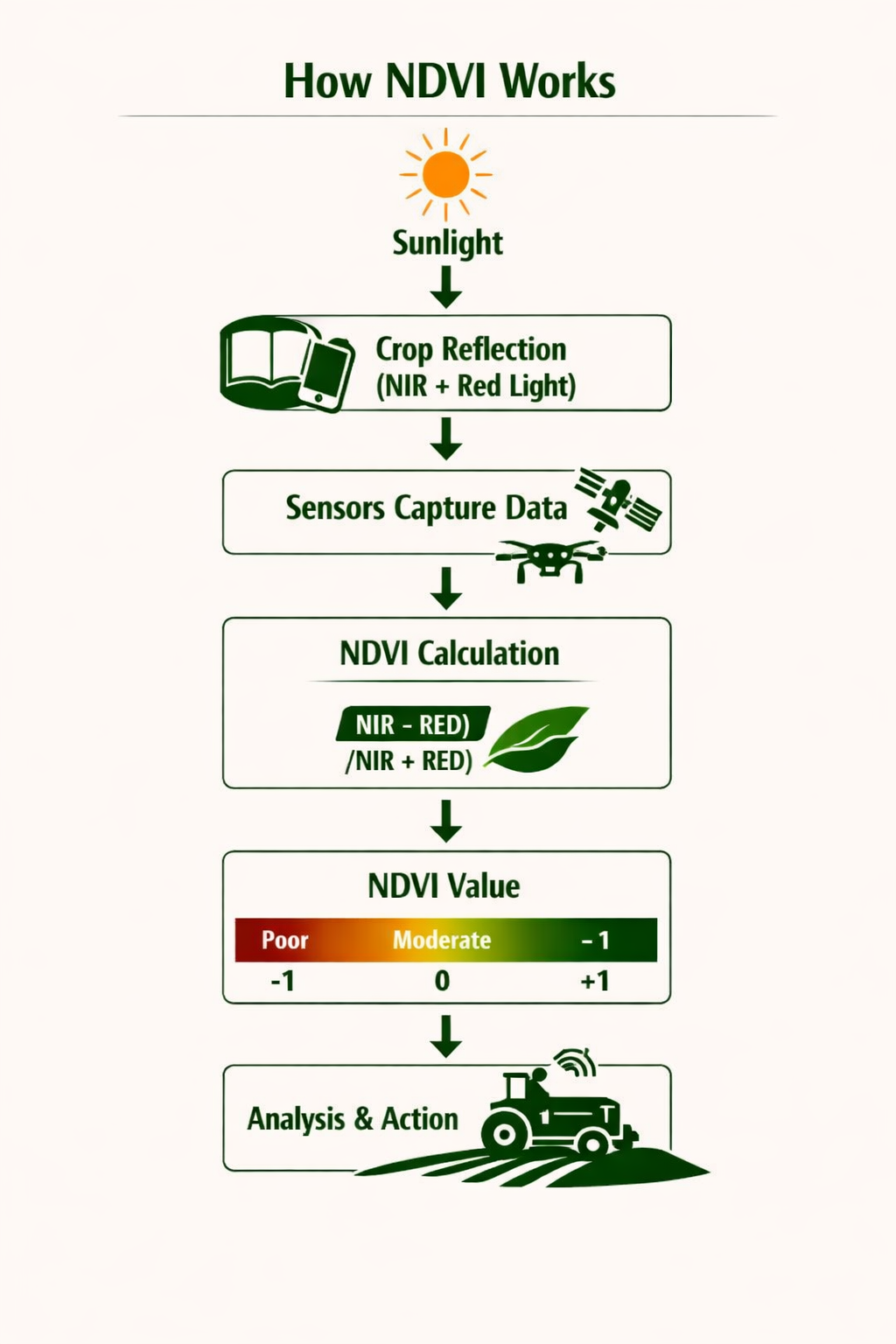
2. Understanding NDVI (Normalized Difference Vegetation Index)
NDVI is one of the most widely used vegetation indices in agriculture. It helps farmers explain, compare, and analyse crop health.
NDVI works by comparing:
· Red light (absorbed by healthy plants)
· Near‑infrared light (NIR) (reflected by healthy plants)
Healthy green plants reflect more NIR light and absorb more red light; stressed or sparse vegetation reflects less NIR.
NDVI values and what they mean
NDVI ranges from –1 to +1:
· Below 0 → water, clouds
· Around 0 → bare soil
· 0.1–0.5 → sparse vegetation
· Above 0.6 → dense, healthy vegetation
These values help farmers identify problem areas and apply targeted actions.
How NDVI Supports Farm Decisions
NDVI helps farmers identify, describe, explain, and analyse what is happening in their fields. It turns satellite or drone data into simple indicators of crop health.
1. Detect crop stress
NDVI allows farmers to identify areas where crops may be stressed by drought, pests or disease.
· Compare current NDVI with historical averages
· Spot areas where vegetation is below normal
· Explain possible water stress or early damage
2. Monitor growth stages
NDVI helps farmers track how crops develop over time.
· Rising NDVI → vegetative growth
· Peak NDVI → flowering or grain filling
· Declining NDVI → maturity or stress
This supports better planning and timing of field operations.
3. Estimate yields and biomass
NDVI values relate to leaf area and photosynthesis. Farmers can analyse NDVI patterns to:
· Estimate biomass
· Predict potential yields
· Apply targeted management where needed
4. Prioritise field visits
Because remote sensing covers large areas quickly, farmers can:
· Identify which fields need attention
· Target scouting
· Plan interventions more efficiently